
They look different to me
-
The SH Membership has gone live. Only SH Members have access to post in the classifieds. All members can view the classifieds. Starting in 2020 only SH Members will be admitted to the annual hunting contest. Current members will need to follow these steps to upgrade: 1. Click on your username 2. Click on Account upgrades 3. Choose SH Member and purchase.
-
We've been working hard the past few weeks to come up with some big changes to our vendor policies to meet the changing needs of our community. Please see the new vendor rules here: Vendor Access Area Rules
You are using an out of date browser. It may not display this or other websites correctly.
You should upgrade or use an alternative browser.
You should upgrade or use an alternative browser.
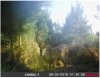
Setup breakdown in new growth pines.
- Thread starter NMSbowhunter
- Start date
- Joined
- Jan 3, 2022
- Messages
- 4,294
I was thinking summer coat vs winter coat and an additional year's time. The white spot and its location are pretty similar.
- Joined
- Jan 3, 2022
- Messages
- 4,294
This was another spot that held bucks. It was new growth pines, and very thick. The pines were about 8 or 10 feet tall and choked down with saw briars and grass. I found a spot where the loggers left a pile of tops and dead logs adjacent to an old skidder landing. The tangle of logs was relatively open to the sky and the pines formed a boundary transition along that opening. The deer were cutting a trail alongside that open spot and bedding on a hillside about 75 yards away. I took a machete and cleared a little lane out and hung a camera. The deer started checking out that little lane and hanging out in there. Notice how the spot is thick to the left and opens up to the sky to the right. It was a ground hunting spot to be sure.
Attachments
Last edited:
Got a 3 day MZ quota this year in a certain wma and I plan to hunt the savanna. I've hunted this particular wma 3x more than any other. I've always concentrated on swamps and always avoided the open flats. Last season the areas I normally go were loaded with other hunters so I ventured out into the flats and killed a deer first sit. I talked with some other hunters and they say they have good luck out there with pics to prove it. I saw lots of deer out there while walking the flats but they always seemed to be in the most random places with no clear rhythm nor reason on why they would be there
- Joined
- Jan 3, 2022
- Messages
- 4,294
That area you show reminds me a lot of the terrain that Ryan Gill hunts. I think he is farther south than you, but it looks like a lot of the same sort of terrain. I like his hunting videos. He gets it done with stone points, self bows and atlatls.
(148) Spot and Stalk Primitive Bow Hunting for Deer - YouTube
(148) Spot and Stalk Primitive Bow Hunting for Deer - YouTube
Here's some pics from an unsuccessful hunt.
Here is a small oak hammock/flag pond out on the flats....I'm the red x the blue is the finger of trees off in the distance and purple was a deer that popped up outta nowhere and walked west until it got into a finger of trees way far away and I lost sight....I didn't really expect to kill anything that day but more of an observation sit


Here is a small oak hammock/flag pond out on the flats....I'm the red x the blue is the finger of trees off in the distance and purple was a deer that popped up outta nowhere and walked west until it got into a finger of trees way far away and I lost sight....I didn't really expect to kill anything that day but more of an observation sit
There may be deer in that landscape but it looks like a square peg in a round hole for a bowhunter. Or at least to this bowhunter.
Welcome to my world.....hahahaha
This wma is really unique....it's 9 miles long and 3/4 of a mile wide. Everybody enters from the south on the only 1 road. The big savanna and sand scrub dominates in the south end and u got more swamp up in the north end. There is a check station u have to talk with a real life person. It opens at 5 so if u wanna be first in and guarantee "ur" spot u gotta get there real early and even then if u got a long walk u be lucky to get into ur tree before dawn if u hunting up north. I don't like rushing trying to get up there just to have vehicles parked already....I'm hoping to learn the savanna....I can be walking in with plenty of time to be settled before dawn and most hunters avoid it like I do/did. This quota is a muzzleloader hunt so I'm trying to think NOT like a bowhunter which is difficult for me
There is this 1 guy in particular that is almost always successful and he hunts the south end. I see his truck parked in the same couple areas all the time so I kinda sorta think I know what he's doing...I think he's hunting along the salt marsh in the tiny pockets of scrub oaks that are out in the savanna habitat....last season he was just finishing up at the skinning rack as I was pulling up with 1 and he noticed my stuff and we gave each other the secret saddle hunter handshake but he had to go....when I see him again this year I'm gonna use the saddles as the conversation started and see if he share some info on what he's looking for. From what I understand his family worked on the property before the state acquired it and he's spent his whole life exploring this piece of land
For the most part all the side roads are walk in only. The big open nothingness down the the south with no roads or trails is the savanna so u can see why most peeps heading north

- Joined
- Jan 3, 2022
- Messages
- 4,294
Any way to put in a boat and jet up to those little islands just south of where the map says Jones creek? Aside from that, it looks on the map like there may be some tiny little strips of land just off Mickler Road. Are those little spots huntable?
I like this thinking and would check all along the waterway from the south end up to those islands.Any way to put in a boat and jet up to those little islands just south of where the map says Jones creek? Aside from that, it looks on the map like there may be some tiny little strips of land just off Mickler Road. Are those little spots huntable?
@Weldabeast Caltopo might be useful for you in figuring out the ditches and drains.
Negative ghost rider...
Jones creek area access from the road system and everything by micklers is private property.
Jones creek area access from the road system and everything by micklers is private property.
- Joined
- Jan 3, 2022
- Messages
- 4,294
Oh, OK I thought the grey shaded areas were good to go.Negative ghost rider...
Jones creek area access from the road system and everything by micklers is private property.
- Joined
- Jan 3, 2022
- Messages
- 4,294
One more thought. If most folks hunt the south end that will likely push deer north. I would look closely at the bottleneck created by McNeil's pond. A good spot might be in that west side of the north end of the pond, away from the road. It looks like a relatively narrow strip between the pond and that canal.
Here it is.... The green in the "middle" is the north tip of McNeil pond and the far side is burned too... I'm o on my bike in the road. That thin strip is definitely on overlooked area but it not holding anything this year. It's normally really thickOne more thought. If most folks hunt the south end that will likely push deer north. I would look closely at the bottleneck created by McNeil's pond. A good spot might be in that west side of the north end of the pond, away from the road. It looks like a relatively narrow strip between the pond and that canal.

Still smoldering 
- Joined
- Jan 3, 2022
- Messages
- 4,294
Too bad they burned it but as a bottleneck to catch fleeing deer it still might not be too bad if you have the reach of a muzzleloader. It should be good again in a few years.
I set my limit 100yds with the iron sights and tring to set up accordingly.
The north entrance is free parking in the off season and that's where I normally do most of my scouting. It cost moneys to park at the south end when it's not a quota weekend. I'll just have to bite the bullet and pay the entrance fee once or twice and get some good half day scouting trips in down the in the south end. It so open and I can see for a long long way I'm thinking of some observation sits in sep...the first hunt isn't until oct in the place. I could get way up there in a jumbo pine with binos. If I plan which tree right I could be watching a bunch of different edges in the heavy flag pond areas
The north entrance is free parking in the off season and that's where I normally do most of my scouting. It cost moneys to park at the south end when it's not a quota weekend. I'll just have to bite the bullet and pay the entrance fee once or twice and get some good half day scouting trips in down the in the south end. It so open and I can see for a long long way I'm thinking of some observation sits in sep...the first hunt isn't until oct in the place. I could get way up there in a jumbo pine with binos. If I plan which tree right I could be watching a bunch of different edges in the heavy flag pond areas
- Joined
- Jan 3, 2022
- Messages
- 4,294
That sounds like a good plan. I would pay the fee a few times to gain easier access to the intel for that area. Hopefully you can pinpoint a few spots where deer consistently travel and then key in your hunts accordingly.
I walked a WMA that’s mostly pine today and noticed lots of red oaks and blackjack oaks along the edges between a section of dense, young pine and older pine with some hardwoods mixed in. It was my first time coming across a blackjack oak - are those worth keeping tabs on?
It was 98F out today and I bumped two deer - one big one about 30yards away from me as I cut into an old hardwood stand in a corner of the WMA. Good intel.
It was 98F out today and I bumped two deer - one big one about 30yards away from me as I cut into an old hardwood stand in a corner of the WMA. Good intel.
Last edited: